South Core

Functional Uses
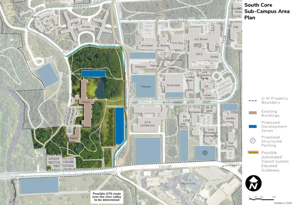
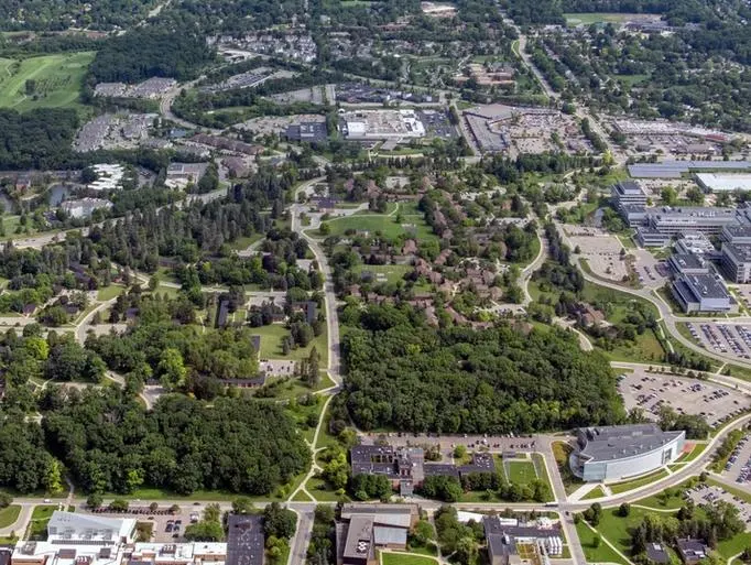
This wooded area is the home to major facilities of the School of Music, Theatre & Dance including the E.V. Moore Building, Brehm Pavilion, and the Dance Building. There is a large commuter parking lot on the north side of Fuller Road.
Development Opportunities
The area west of realigned Murfin Avenue provides a significant opportunity for new programmatic uses along Bonisteel Boulevard and potentially along Fuller Road beyond 25 years. These sites offer opportunities to establish greater density, walkability, and an activity node near Fuller Road and create a new, vibrant gateway to North Campus. The site along Bonisteel requires strong architectural expression given it will help define the major gateway entry to North Campus. Development on Bonisteel also requires consideration of the steep topography and the associated accessibility challenges. With the potential of locating development on the current west segment of Bonisteel, changes to pedestrian, bicycle, and vehicular patterns in this area require consideration of the topography and accessibility goals. There is an opportunity to carefully locate an expansion of the Moore Building to its north, allowing for more programmatic space while also drawing the facility closer to Murfin and the performing arts facilities established near the Gerstacker Grove.
Landscape and Public Realm
Landscape in the area west of Murfin is defined by the pond located in the clearing east of the E.V. Moore Building. Designed by Eero Saarinen to mimic the shape of a grand piano in the plan, the pond provides a tranquil setting surrounded by a system of pathways through the surrounding wooded areas. Views through and into this setting, including those of the historic east facade of the Moore Building, should be preserved and enhanced. Improvements to the pathway network are suggested, especially in areas where accessibility challenges exist. Stronger linkages are also proposed to connect the area to the new possible ATS and proposed BRT stations at Pierpont.
Mobility and Connectivity
The existing pathways in the area are maintained and extended to connect with existing and proposed trails in the surrounding wooded areas, notably those located to the west of the E.V. Moore Building. An opportunity exists to connect pedestrians moving from Fuller Road and the large existing parking lot up the slope to the Dance Building, offering another connection into North Campus from the Mitchell Field area. Given the topography, careful consideration is needed to ensure universal access.
Sustainability and Infrastructure
Future development provides opportunities to concurrently integrate geo-exchange and ground source heat pumps, solar PV, stormwater management systems, and forestry management best practices.
Next Up:
-

Innovation District
The proposed area for the Innovation District is bound by Plymouth Avenue, Murfin Avenue, Hubbard Street, and Millers Creek, east of the North Campus Research Complex.
-

East Core
The East Core Area is bound by Hubbard Street, the walking paths connecting Hayward Street to Hubbard Street, Beal Avenue extending northward, parking lot NC-19, and Huron Parkway.
