Northeast Area

Functional Uses
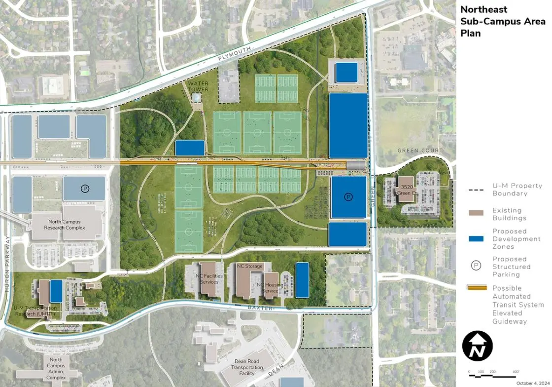
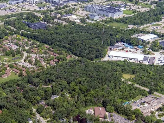
Located at the northeast corner of North Campus, the Northeast Area is generally defined by Plymouth Road on the north, Green Road on the east, Millers Creek on the west, and Baxter Road on the south. It houses research, academic, and support facilities. The units within the Northeast Area include Mcity; U-M Transportation Research Institute (UMTRI); Stamps School of Art and Design; Michigan Engineering; Student Life; and several major support functions.
Development Opportunities
The plan identifies this area largely as a proposed recreation and geo-exchange and ground source heat pump complex including a new parking structure, and possible ATS station and maintenance facility. The proposed development responds to broader campus needs and objectives.
A new complex is proposed for intramural and recreation activities designed to support health, well-being, inclusion, and engagement objectives. The complex addresses the relocation of fields from Mitchell Field as well as anticipated student needs including adaptive sports. The intent is to create a destination fitness and recreation complex made possible by the possible ATS and proposed BRT systems. A major geo-exchange bores and ground source heat pump area beneath the fields and facilities of the new complex will supply the energy required for the complex itself and larger areas of NCRC and beyond in North Campus.
The location of a deck on Green Road positions parking where traffic can be “intercepted” before entering the campus. Peripheral parking connected to major destinations such as the Medical Center Campus serves the needs of the commuting population in an efficient and convenient manner. A new fire station near the southwest corner of Plymouth Road and Green is proposed to replace a facility currently located in the Northwood area.
Landscape and Public Realm
The eastern reaches of Millers Creek organize the land use and circulation patterns of the Northeast Area. Pathways and bicycle routes along the creek system and in the woods connect the area to the NCRC and areas south of Hubbard Street. The proposed recreation fields, support facilities, and pathway and trail network in combination provide the opportunity to create a major new campuswide amenity in support of the health and well-being goals of the university. Views providing visual connectivity between the recreation fields and development along Green Road and the Innovation District to the west should be preserved and enhanced. These trails and other opportunities for public access to nature contribute to the environmental justice goals of the university.
Mobility and Connectivity
The Northeast Area is connected to the Innovation District, Pierpont, the Medical Center Campus, and Central Campus by means of the elevated possible ATS system, making it an accessible location in support of campuswide health and well-being initiatives. The possible ATS station is integrated with a proposed parking deck to facilitate use by those working on the North, Medical Center, and Central campuses. The possible ATS system is supplemented by proposed BRT services linking the area to the remainder of the Ann Arbor Campus. The complex is also connected by the extensive pathway and trail networks with connections leading to the NCRC, Innovation District, and Central Core Areas. A service and storage facility for the possible ATS system is envisioned as part of the area.
A new internal support road is shown extending from the U-M Transportation Research Institute on the west to Green Road on the east, intended to support U-M service access to adjacent facilities, the geo-exchange and ground source heat pumps, and recreation fields.
Baxter Road and Green Road are designated to support bus service extending into North Campus and continuing to East Medical Campus along Plymouth Road, and southwest to link the Medical Center, Central, and Ross Athletic campuses.
Sustainability and Infrastructure
The Northeast Area is critical for the large-scale geo-exchange and ground source heat pump system needed for existing and proposed facilities across North Campus. Installation of the system requires careful site planning relative to existing subsurface conditions near Millers Creek and the construction of the recreation complex. Designating utility corridors that connect the geo-exchange field and ground source heat pump infrastructure westward to the rest of North Campus is crucial for future site planning and implementation strategies. Other opportunities include an integrated stormwater management strategy designed to minimize the impact on Millers Creek. Coordination of the stormwater management strategy and proposed pathway and trail networks are important considerations for future landscape and site design recommendations, especially in the context of optimizing the quality of Millers Creek. Biodiversity should be promoted as areas are redeveloped. Solar PV opportunities include building rooftops as feasible, and the parking structure proposed along Green Road, as well as other existing buildings and proposed future development as feasible.
Next Up:
-

East Area
The East Area is located south of the Northeast Area. It is bound by Baxter Road, Huron Parkway, Green Road, and private housing to the south.
-

Mitchell Field
Located in the Huron River Valley, the Mitchell Field Area is generally defined by the Huron River on the south and west, Fuller Road on the north, and Fuller Court on the east.
