Draper Road

Functional Uses
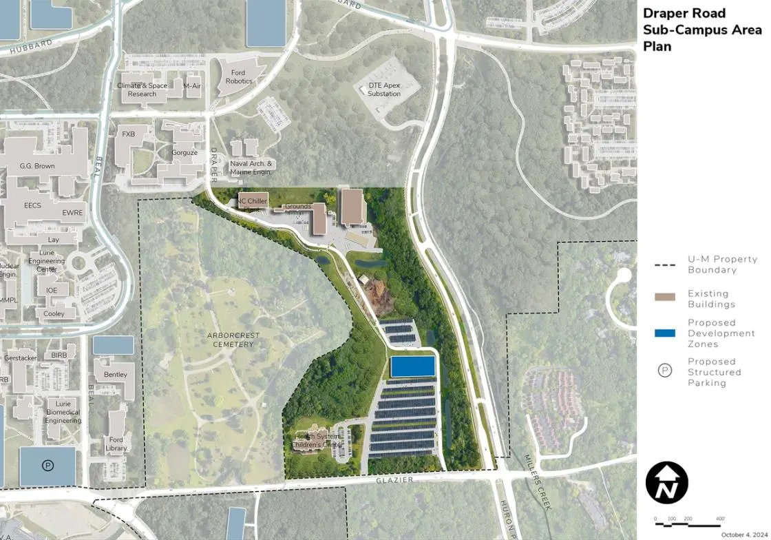
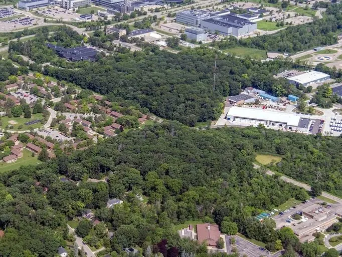
The Draper Road Area is located south of the East Core Area. It is defined by Glazier Way on the south, Huron Parkway on the east, and the edge of the privately owned Arborcrest Cemetery to the west. Currently, it is the location of service-related facilities including the North Campus Chiller Plant, several grounds-related facilities, a systems support facility, stormwater detention, a childcare center, and commuter parking. Draper Road connects Hayward Street to Glazier Way; it includes an unpaved section and currently is not open to the public. The units represented within the Draper Road Area include U-M Health and several support functions including surface parking.
Development Opportunities
One new development zone is identified on a large existing surface parking lot, providing an opportunity to add support services as needed.
Landscape and Public Realm
The landscape in this area is defined by natural buffers along both the cemetery to the west and Huron Parkway to the east, the large commuter parking lot, and storage areas supporting Grounds operations. Beyond the childcare center and commuter parking lot, the area is not intended for public use or access.
Mobility and Connectivity
The existing large parking lot functions as a remote commuter lot served by U-M transit. Bus circulation and service vehicle access to the area should be maintained while carefully considering how to optimally separate these uses from the childcare center operations.
Sustainability and Infrastructure
The Draper Road Area is reserved for operations and support services serving campuswide needs. One development site is shown to accommodate future needs. The NC 51 parking lot is designated for geo-exchange bores, ground source heat pumps, and potential solar PV installations to serve the energy needs of the Central Core. Distribution lines will be situated along Draper Road, integrating it into the campus utility and infrastructure corridor system. Future development should take into account the stormwater impacts on the Millers Creek drainage way, which runs adjacent to the site along Huron Parkway.
Next Up:
-

Northeast Area
Located at the northeast corner of North Campus, the Northeast Area is generally defined by Plymouth Road on the north, Green Road on the east, Millers Creek on the west, and Baxter Road on the south.
-

East Area
The East Area is located south of the Northeast Area. It is bound by Baxter Road, Huron Parkway, Green Road, and private housing to the south.
