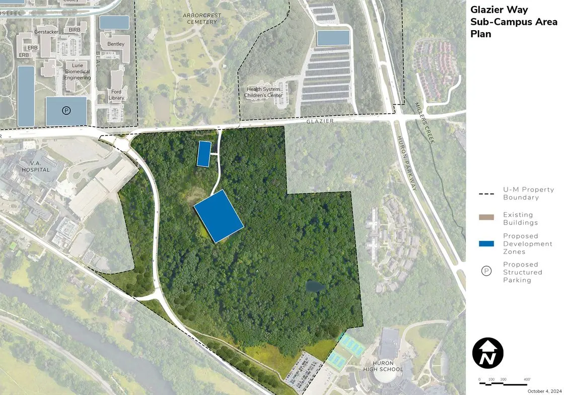
Glazier Way

Functional Uses
Located southeast of the Central Core Area, the Glazier Way Area is bounded by Glazier Way on the north, Fuller Road on the south, the VA Hospital to the west, and private residences and a public school to the east. The area is heavily wooded except for a remote parking location at the center of the site and a sidewalk that runs adjacent to Fuller Road. This area is only used for support functions.
Development Opportunities
The area is designated for limited future operations and support uses.
Landscape and Public Realm
The area is largely wooded today, with public access limited to sidewalks along the perimeter roads. As a support area, it is not envisioned to adjust the landscape for public use. Mobility and Connectivity Existing public walks along perimeter roads should be maintained, while limiting any internal connectivity to authorized support functions.
Sustainability and Infrastructure
A potential DTE substation, which would be required for the electrification of campus operations and transportation, could be placed on the site.
