Central Core - South of Bonisteel

Functional Uses
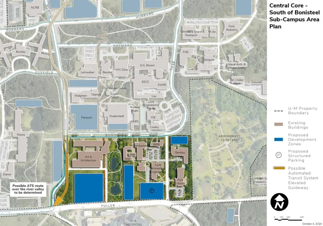
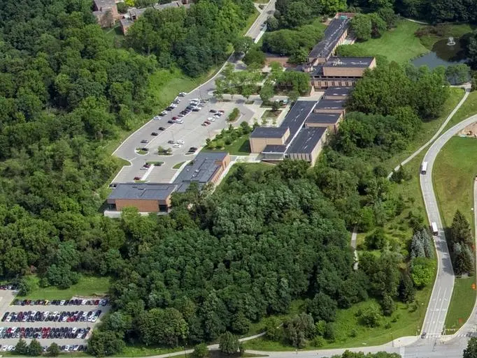
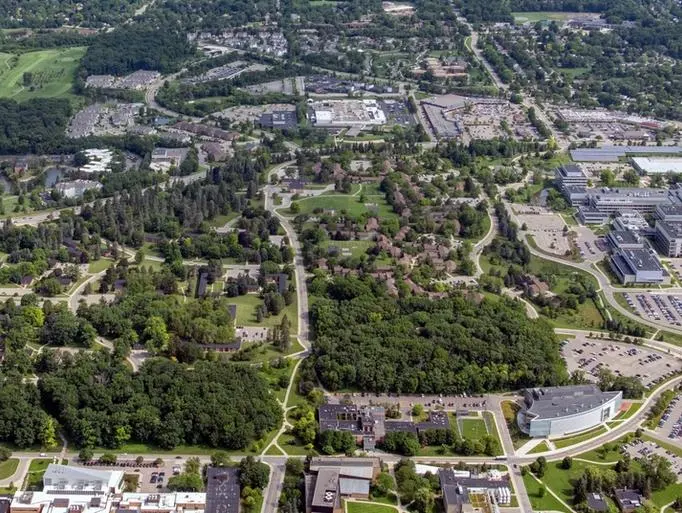
The area south of Bonisteel is defined by Fuller Road on the south, Bonisteel on the west and north, and the Arborcrest Cemetery on the east. This area slopes downhill toward Fuller Road and includes a variety of academic and research buildings organized around a central stormwater feature. A network of pathways connects the facilities, which include academic, library, and support. Units located within this area include the Stamps School of Art and Design, the A. Alfred Taubman College of Architecture and Urban Planning, Michigan Engineering, Gerald R. Ford Presidential Library and Museum, University Libraries, and surface parking.
Development Opportunities
The area south of Bonisteel has additional infill development sites which include:
- Art and Architecture Building Expansion. A site south of the existing facility, which is currently surface parking, is available. Given its peripheral location on Fuller and the sloping topography, structured parking could be integrated on the lower levels of future development offsetting the loss of the existing surface parking lot.
- Parking Structure. A parking structure could be located on the northwest corner of Beal and Fuller to meet current and future demand; it could also be integrated with programs, similar to the site to the west of it on Fuller.
- Bentley Historical Library. An expansion site for an undefined purpose north of the existing building. This is a strategic site and care should be given to selecting highest and best use.
Landscape and Public Realm
The landscape and open space structure of the area focuses on the qualities of the central stormwater management system of ponds descending from Bonisteel to Fuller Road. Enhancements are proposed to the landscape surrounding the ponds, including the addition of a new potential plaza along Bonisteel Boulevard. The plaza and surrounding green space is positioned at the top of the hill with views downhill over the ponds.
Surrounded by informal pathways, many with accessibility challenges, the area lacks landscape structure. Proposed development south of Art and Architecture and west of the Engineering Research Buildings would establish a formal structure and landscape expression along Fuller Road. Improved accessible pedestrian paths, lighting, and signage are proposed in this area. There is an opportunity to add public art strategically integrated along the pathways and green spaces surrounding the stormwater ponds, adding interest and enhancing a sense of place. The pathways here should connect to new bus stops proposed along Fuller Road.
Mobility and Connectivity
Proposed BRT services along Bonisteel provide opportunities to improve the streetscape and enhance the landscape along this important eastwest boulevard. The integration of parking structures south of Art and Architecture and the Engineering Research Buildings improves accessibility and helps redefine the Fuller Street edge. Universal design principles should guide the future pathway network to ensure accessibility.
The Bonisteel Boulevard gateway to North Campus, defined today by a pair of two-lane swooping roadways that transition uphill from Fuller Road, is reconfigured and realigned in the plan. Reconfiguration of Bonisteel in this area opens up land for additional development to the west of the road. Shared-use paths are proposed on the east and west sides of the reconfigured Bonisteel Boulevard from Fuller Road to Murfin Avenue.
Further enhancement and reinforcement of the northsouth, non-motorized spine running adjacent to Art and Architecture is recommended, as it is a part of the larger central circulation spine extending between Fuller and Plymouth. Shared use paths or bike lanes should be considered along other roadways.
Sustainability and Infrastructure
Geo-exchange and ground source heat pumps should be considered under all future development, as well as consideration for emerging technology such as pyramidal boring where larger open space for geo-exchange and ground source heat pumps is not available. The area should be planned to integrate into future looped geo-exchange and ground source heat pump systems on North Campus. Solar PV should be integrated into new development and considered on existing buildings where feasible to replace the solar PV array displaced by proposed development. Capacity upgrades should also be considered to the stormwater management ponds to compensate for proposed development, with an eye toward enhancing biodiversity in planted areas.
Next Up:
-

South Core
This wooded area is the home to major facilities of the School of Music, Theatre & Dance including the E.V. Moore Building, Brehm Pavilion, and the Dance Building.
-

Innovation District
The proposed area for the Innovation District is bound by Plymouth Avenue, Murfin Avenue, Hubbard Street, and Millers Creek, east of the North Campus Research Complex.
