Oxford

Functional Uses
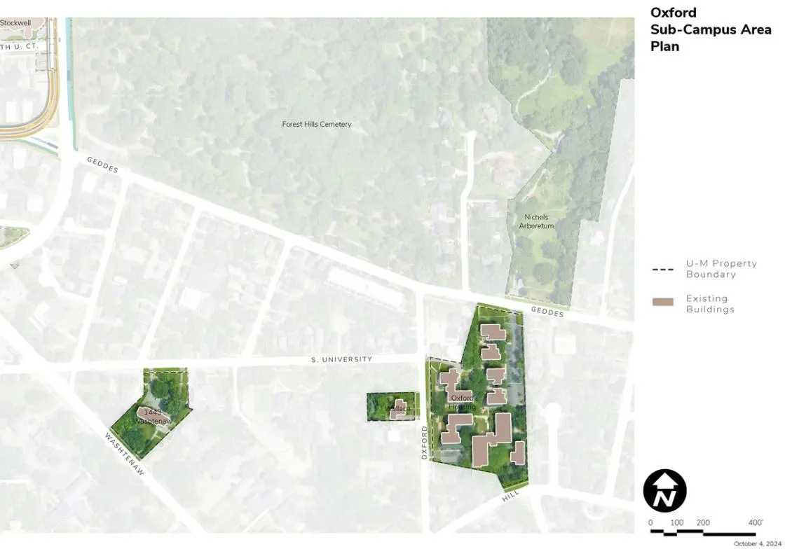
Located south of Nichols Arboretum and bound by Oxford Road, Hill Street, Geddes Avenue, and private homes to the east, the Oxford Housing complex, operated and managed by Student Life, is made up of seven small apartment buildings. The Oxford Area also includes Student Life’s 1443 Washtenaw Avenue Building and the Provost’s Mike and Mary Wallace House.
Development Opportunities
Campus Plan 2050 calls for the renovation and upkeep of the Oxford Housing facilities and grounds to continue to provide housing. Potential site improvements are also being explored at 1443 Washtenaw.
Landscape and Public Realm
Existing green spaces provide support for the student experience and for student health and wellbeing, as well as passive recreation, collaboration, and engagement.
Mobility and Connectivity
The area is connected to other parts of Central Campus via an existing bus route, as well as the neighborhood sidewalk system. The close proximity via sidewalks to the Nichols Arboretum to the north is a key feature. A moderate amount of parking is integrated into the area, dedicated to serving the visitor, service, and ADA needs of the existing facilities.
Sustainability and Infrastructure
Integration of solar PV should be considered on existing buildings if feasible and during potential future redevelopment. Lack of unencumbered open space likely makes the addition of geo-exchange and ground source heat pumps impractical within the existing development, but the technology should be considered during potential future redevelopment.
Next Up:
-

Nichols Arboretum
Bounded by Geddes Avenue to the south, the Huron River to the north, Forest Hill Cemetery and the Medical Center Campus to the west, the 123-acre Nichols Arboretum is operated by the university.
