Diag Area

Functional Uses
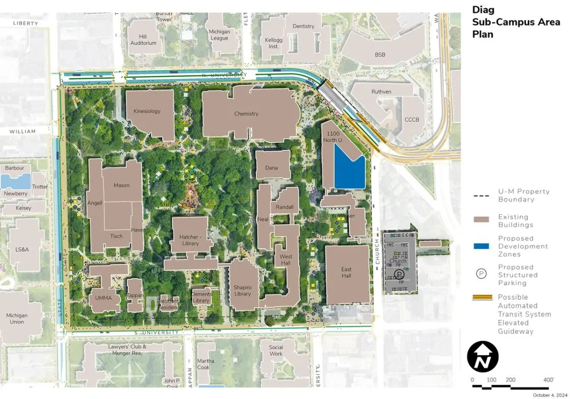
Located in the “heart” of Central Campus, the Diag Area is bounded by North University Avenue, South State Street, South University Avenue, and Church Street. Home to some of the oldest structures on campus, and many of the university’s main libraries, the buildings predominantly support academic activities; however, the President’s House and the University of Michigan Museum of Art (UMMA) are also included. The units represented within the Diag Area include the School for Environment and Sustainability (SEAS); the School of Kinesiology; numerous departments associated with the College of Literature, Science, and the Arts (LSA); and University Libraries. The Church Street Parking Structure is also located on the east edge of this sub-campus area.
Development Opportunities
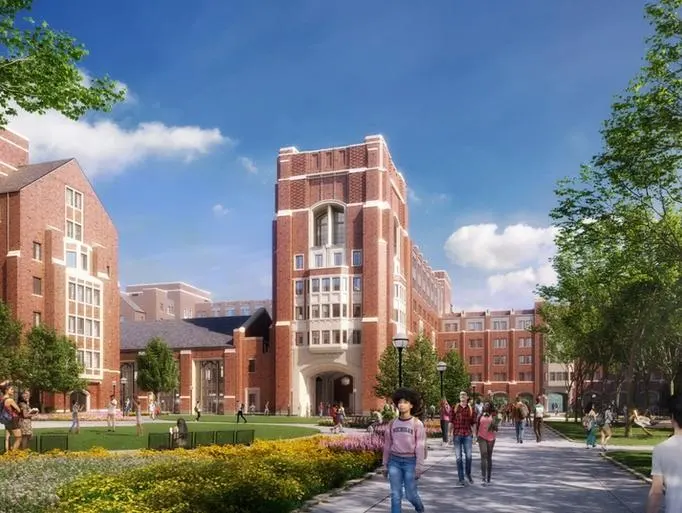
Campus Plan 2050 calls for the strategic reinvestment in all buildings located in the Diag Area with the goal of addressing academic and research programmatic needs to improve energy efficiency, deferred maintenance, and accessibility issues. One potential infill site exists on Church Street as an addition to the 1100 North University Building to meet future, mission-driven priorities.
Landscape and Public Realm
The Diag Area is the most memorable and treasured landscape of the U-M campus, defined by patterns of movement, the central foreground plaza to the Hatcher Library, and a dense canopy of trees. The central plaza area functions as the ceremonial and geographic heart of Central Campus, hosting significant numbers of programmed and unprogrammed student events, informal gatherings, and other major campus initiatives and gatherings in the furtherance of public discourse, campus engagement, and health and well-being. Views across the Diag, especially along the open space extending north to Ingalls Mall, should be carefully preserved and enhanced. In addition, the open lawn spaces along State Street in front of Angell Hall, Alumni Memorial Hall, UMMA’s Maxine and Stuart Frankel and Frankel Family Wing, are frequently programmed for campus events and should continue to be protected for this use, as are the open spaces and plazas along the East University pedestrian mall. The iconic viewshed up and down State Street, flanked by historic university buildings, should be preserved and enhanced, along with the view looking north along the East University pedestrian mall toward the pedestrian and building nexus at North University Avenue. Campus Plan 2050 calls for the enhancement of the character and quality of the landscape and public realm, especially in areas where changes may be necessary in response to accessibility requirements.
Landscape and public realm improvements are proposed on North University Avenue where the possible ATS and proposed BRT stations require changes to pathway, bike, and transit circulation and the introduction of an elevated guideway in support of safety, health and well-being, and enhanced connectivity. Public realm improvements are also seen as opportunities for creating a new destination and plaza with the potential for increased collaboration opportunities.
The high quality and age of the tree canopy within the Diag area enhances the character of the open spaces and should be enhanced and protected as possible when future renovations and utility infrastructure projects are planned. This includes successional planning of the urban tree canopy and an effort to diversify species for resiliency.
Mobility and Connectivity
Accessibility is a key consideration in the Diag Area given the number of historic buildings and the associated barriers. A comprehensive accessibility study will be considered with the goal of establishing an integrated approach for the Diag Area, among other areas. A key mobility consideration for the Diag Area includes the integration of the possible ATS and proposed BRT station on North University Avenue.
The potential installation of proposed dedicated BRT along South State Street public right of way includes new bike lanes, accessible pathways, and landscape. With this comes the opportunity to improve the streetscape, stormwater functionality, and the foreground landscapes to the iconic Angell Hall and University of Michigan Museum of Art. See the West State Street Sub-Campus Area for details on the South State Street changes.
The plan indicates the potential installation of onstreet metered parking on segments of South University Avenue, east of Shapiro Library, to provide visitor parking while including marked bike lanes adjacent to the parking stalls, providing connectivity between destinations along the street in coordination with the City of Ann Arbor.
Sustainability and Infrastructure
Opportunities for geo-exchange and ground source heat pumps are limited in the Diag Area due to existing underground infrastructure such as steam tunnels and the dense tree cover. Subject to further study, geo-exchange bores and ground source heat pumps may be possible along South State Street in conjunction with the installation of the proposed BRT lanes, bike lanes, and new pathways. Buildings in the Diag Area should be assessed for potential energy infrastructure upgrades, including connecting as feasible to a future looped campus geothermal distribution system. Subject to structural evaluation, it is recommended that solar PV be considered for existing buildings with large flat roof areas.
Next Up:
-

Monroe Mall
Located directly south of the Diag Area, the Monroe Mall Area is bound by South University Avenue, South State Street, Hill Street (just past Forest Avenue), Forest Avenue, and East University Avenue.
-

Elbel Field
The Elbel Field Area is located north of the Stephen M. Ross Athletic Campus and is bound by East Hoover Avenue, South Division Street, East Madison Street, the Ann Arbor Railroad, and Greene Street.
