Ferry Field

Functional Uses
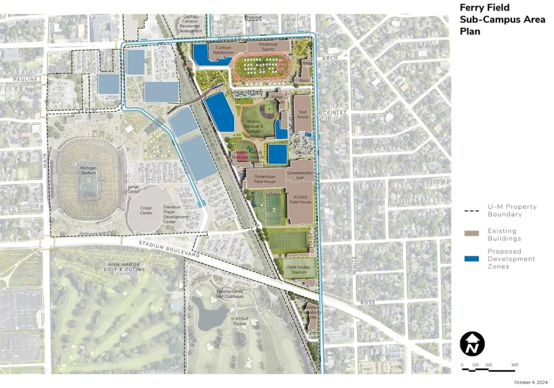
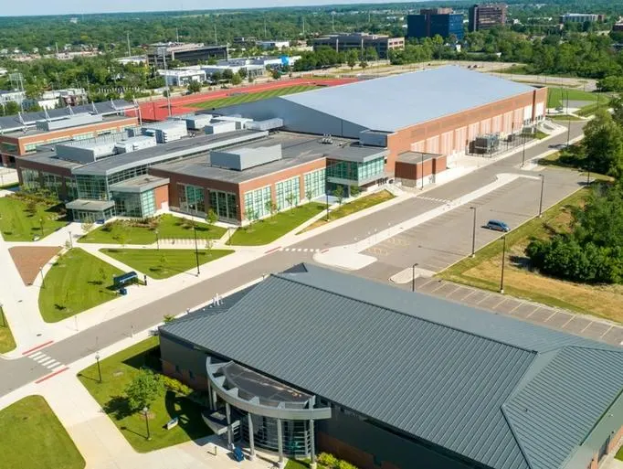
Located due east of the Kipke Drive Area, the Ferry Field Area is defined by East Stadium Boulevard on the south, a railway on the west, East Hoover Avenue on the north, and South State Street on the east. The buildings include a mix of Athletics and support facilities, a facility for the Michigan Marching Band, and surface parking lots. The School of Music, Theatre & Dance, along with several athletic functions, are supported in this area.
Development Opportunities
In the Ferry Field Area, strategic demolition and redevelopment is proposed to improve accessible circulation and connectivity, as well as support new programmatic needs for Athletics. Proposed facilities and open spaces are defined by the Ferry Field open space and a new pathway leading from a restored open pedestrian gateway at East Hoover Avenue and South State Street to a non-motorized and pedestrian bridge proposed over the railway connecting to the Kipke Drive Area. Restoration of Ferry Field includes the installation of geo-exchange bores and potentially a new informal playing surface and track.
Landscape and Public Realm
A stadium at Ferry Field was the home of Michigan Football from 1906 to 1927, when Michigan Stadium opened, and served as the site of U-M’s outdoor track and field activity until 2018. Today, the field itself is used for a variety of training purposes by multiple university teams as well as the public. It also serves as an informal open space on the Ross Athletic Campus defined by the iconic south facade of the Intramural Sports Building. The proposed demolition of Weidenbach Hall and the Cliff Keen Arena at the southwest corner of South State Street and East Hoover Avenue reestablishes views into the historic field, providing the opportunity to recreate the original Ferry Field gateway designed by Albert Kahn. New pathways connect the gateway to the proposed pedestrian bridge linking the Ferry Field Area to the a dedicated TV fan zone and lawn area east of Michigan Stadium, creating a major fan connectivity corridor from the north on football game days as well as other events. The link also enhances daytime and weekday operations and campus circulation. Views to be preserved and enhanced include that of the historic Intramural Sports Building facade as well as the view from the newly established open gateway at State Street across Ferry Field toward Michigan Stadium. New greenspaces should support daily use as well as programmed and event-day uses, with efforts made to include areas promoting biodiversity.
Mobility and Connectivity
Mobility and connectivity improvements in the Ferry Field Area focus on new pathways and the pedestrian bridge connecting the area for the Kipke Drive area and Michigan Stadium west of the railway. Other improvements in the area include the addition of proposed BRT lanes and stops along East Hoover Avenue and South State Street. Major bike parking facilities are proposed near the Natatorium/Track, South Ferry Field, and Yost Ice Arena. The pedestrian circulation network should be carefully enhanced and developed to support ease of wayfinding and better separation of pedestrians and vehicular flow.
Sustainability and Infrastructure
In support of U-M’s sustainability and climate action goals, geo-exchange bores are proposed under Ferry Field and the surrounding paved areas. Geo-exchange borings are also recommended under the baseball, softball, field hockey, and football practice fields and as feasible. Installation should be considered as each field requires major upgrades. Buildings in the area should be considered for energy retrofits to support connection to the geo-exchange and ground source heat pump system. Linking the geo-exchange and ground source heat pump infrastructure to the Kipke Drive Area via the proposed pedestrian bridge as a utility conduit should be considered. Subject to structural analysis and building compatibility, solar PV panels are recommended on existing flat-roofed buildings and on all future as feasible and prudent. As areas are redeveloped, consideration should be given to incorporate stormwater best practices given the proximity to Allen Creek.
Next Up:
-

South Complex
The South Complex Area is located at the southern end of the Ross Athletic Campus. It is bounded generally by South Main Street to the west, the U-M Golf Course to the north, South State Street on the east, and private development to the south.
-

Golf Course
The golf course is defined by East Stadium Boulevard on the north, South State Street on the east, the South Complex on the south, and South Main Street and Ann Arbor Golf and Outing on the west.
