Landscape and Sustainability

Stormwater Infrastructure
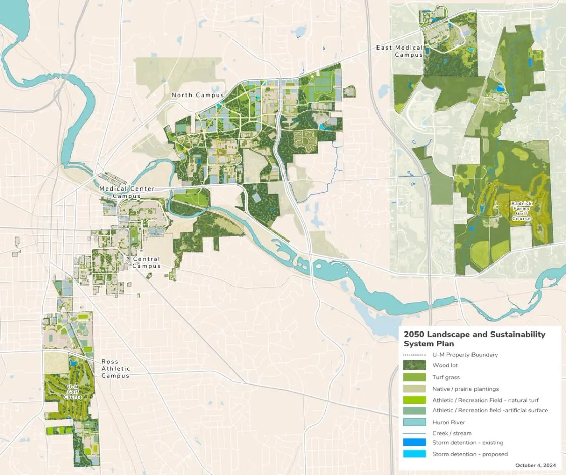
Campus Plan 2050 integrates landscape improvements with stormwater, reforestation, food production, and connectivity goals. Stormwater recommendations focus on the management of water and soil resources utilizing functionally and aesthetically integrated best management practices (BMPs). BMPs address water quantity and quality requirements while simultaneously enhancing aesthetic qualities.
The management of stormwater on each campus involves three primary zones or circumstances, tailored to their specific contexts:
Developed Areas (e.g., Central Campus and the Medical Center Campus): These locations utilize existing underground conveyance systems and storage facilities for stormwater management. Generally, these systems will remain unchanged, except in areas slated for redevelopment, where Best Management Practices (BMPs) could be integrated with the landscape framework.
Stream Buffer Zones: Protection buffers ranging from 25 to 50 feet from the edge of embankments are proposed along all major sections of Fleming Creek, Millers Creek, the Huron River, Allen Creek, and Mallets Creek on the Ann Arbor Campus.
Natural Plantings: Additional native plantings are proposed for various areas across the campus to enhance stormwater management and ecological health. Suitable soils for infiltration should also be explored.
Landscape
The landscape system for Campus Plan 2050 is informed by the natural features and ecosystems of the campus and surrounding context as well as the formal landscapes and circulation networks that define the overall open space structure. It provides direction for improvements to streetscapes, enhancements to gateways, entrances, and wayfinding at existing and proposed locations, and provides site furnishing guidance to promote unity and contribute to the experience of the public realm.
The plan includes several types of landscapes:
The natural features of the plan include the Huron River Valley, wooded areas, wetlands, streams, and ponds located across the Ann Arbor campus with significant concentrations found on Ross Athletic Campus, Central Campus (Nichols Arboretum), North Campus, East Medical Campus, and the east Ann Arbor properties (Matthaei Botanical Gardens and Radrick Farms). These natural features are connected to the larger system of parks and nature areas in Ann Arbor and are important in terms of the ecosystem functions they provide relative to biodiversity and stormwater management. Campus Plan 2050 integrates these features into the open space structure of the campus by designating them as preserved land uses and by improving pathway connections to and through them. New pathways in wooded areas will require
The plan aims to emphasize opportunities to increase biomass and ecosystem support wherever possible, and to limit the amount of lawn areas which do not promote stormwater infiltration.
Proposed areas of reforestation on North Campus enhance existing natural features in the interest of:
- Facilitating carbon sequestration, stormwater management, erosion control, water quality protection, and species diversity.
- Providing proximate areas of respite in support of health and well-being objectives.
- Heightening public awareness of the relationship between human settlements and the natural environment.
- Promoting wildlife movement corridors.
The formal or “structured” landscapes of the framework include memorable and iconic landscapes as well as the interstitial areas and circulation corridors. Formal landscape examples include the Diag, Ingalls Mall, and Palmer Field on Central Campus; Ferry Field on the Ross Athletic Campus; and Gerstacker Grove and the Wave Field on North Campus. Campus streetscapes and circulation corridors further define the open space structure along with significant stormwater management landscapes.
The landscape and sustainability system offers guidance on preservation and enhancement of both natural and established formal landscape areas. Important viewsheds that exist are protected, and new viewsheds are created as part of the plan.
For more detail on landscape and viewsheds, see Section 4 subcampus area descriptions.
Food production gardens and research areas provide opportunities for campus engagement, and for research and academic support activities. Nichols Arboretum and Matthaei Botanical Gardens contribute to these opportunities for recreation, exercise, teaching, and research activities. In the North Campus housing redevelopment areas, the plan identifies opportunities for food production gardens with the intent of fostering community engagement and well- being, and to promote the campus as a living lab.
The open space framework integrates campus gateways, entrances, and wayfinding strategies with streetscape and landscape enhancements with the goal of welcoming members of the campus and community. Recommended gateways offer opportunities for landscape features, signage, landmarks, public art, and other orientation elements, which, in combination, contribute to wayfinding on campus. The plan identifies opportunities along Plymouth Road at Green Road and Huron Parkway, Beal and Murfin intersections, and along Fuller Road at Bonisteel and Beal. A proposed future athletic facility located on South State Street in the South Complex of the Ross Athletic Campus contributes to a new campus gateway along South State Street.
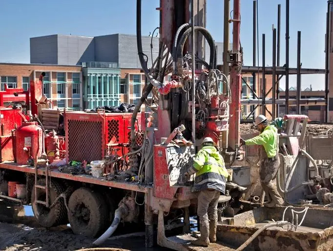
Campus Plan 2050 promotes the health and well- being of the campus population by reserving land for outdoor recreation fields and pathway networks. To that end, a proposed outdoor recreation complex on North Campus provides informal and programmed recreation activities. The recreation complex provides much-needed field space in addition to existing fields at Palmer Field on Central Campus and the Hubbard Street Recreation Fields on North Campus, among others. The proposed recreation complex is coordinated with the geo-exchange bores and ground source heat pumps proposed as part of the North Campus decarbonization strategy.
Pathways and Trails
Campus Plan 2050 illustrates a comprehensive and integrated network of pathways and trails designed to facilitate connectivity across the Ann Arbor campus, promote health and well-being goals, and promote access to nature in support of environmental justice. Proposed improvements include:
- Accessibility pathways in areas associated with new buildings or major site or landscape design projects. The plan embraces the principles of Universal Design to inform future design decisions to create an accessible and welcoming environment over time.
- New connections within each campus, between campuses and to adjacent areas. A key recommendation is the new pedestrian and bike bridge over the Huron River designed to facilitate pedestrian and bicycle connectivity between the Central, Medical Center, and North campuses. Additionally, a railway underpass is proposed to connect Nichols Arboretum with Mitchell Field. This underpass will also link to the Border-to-Border Trail, which runs along the Huron River from the city's Gallup Park. A third connection is proposed on the Ross Athletic Campus with a pedestrian bridge linking the Ferry Field area to Kipke Drive over the existing railroad tracks to enhance connectivity and mobility.
Bicycles
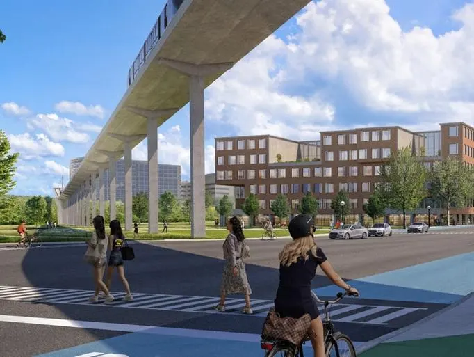
Campus Plan 2050, informed by the City of Ann Arbor’s focus on bicycle connectivity, provides a comprehensive network of campus bike facilities on U-M property linked to those of the community. The network includes connections within and between each campus. Major parking areas at transit stations and centers, and major campus destinations such as unions, libraries, and academic buildings enhance the user experience and convenience. Where practical and appropriate for the context, covered bike parking may be considered to enhance the commuter experience. Potential locations also include parking structures, areas beneath the possible ATS guideways and transit stations, and future residential buildings, where applicable.
Next Up:
-

Climate Action
The plan supports U-M’s sustainability and climate action goals by the large-scale installation of geo-exchange fields and ground source heat pumps to meet the heating and cooling needs of campus facilities.
-

Transit
The plan takes into consideration existing transportation infrastructure and identifies future project priorities and/or directions that will help the university coordinate multi-modal improvements and achieve an integrated system.
